Adolf Munkel Trail | Val di Funes in the Dolomites
By Roberto (Updated Oct 25)
⏱ 9 minutes
If you’re planning a trip to the Italian Dolomites and looking for a truly memorable (but manageable) hike, you should consider the Adolf Munkel Trail (also called Adolf Munkel Weg or Via delle Odle). This hike is the one we liked the most after Seceda from Col Raiser, so we absolutely recommend it.
Perhaps it’s not as famous as Tre Cime, Lago di Sorapis or Cinque Torri, but this trail, located in the valley of Val di Funes (Villnöss Valley) and right under the Odle Group, offers spectacular scenery, changing paths and views and one of the best located rifugios in the world. Yeah, why not, in the world!
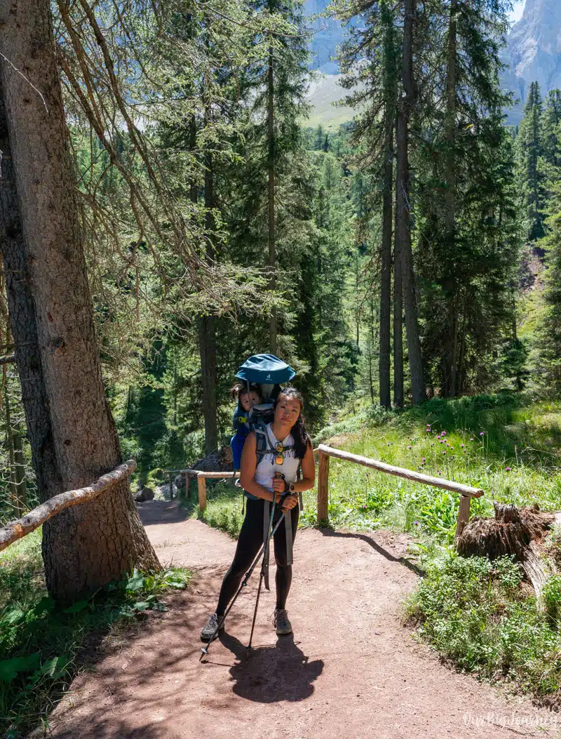
In this post, we talk about why we liked it, how to get there, trail details, what to expect along the way, and many other things. We did this hike with our baby Lara. In can you want extra advice for the Dolomites with kids, check our Full Guide. Keep reading!
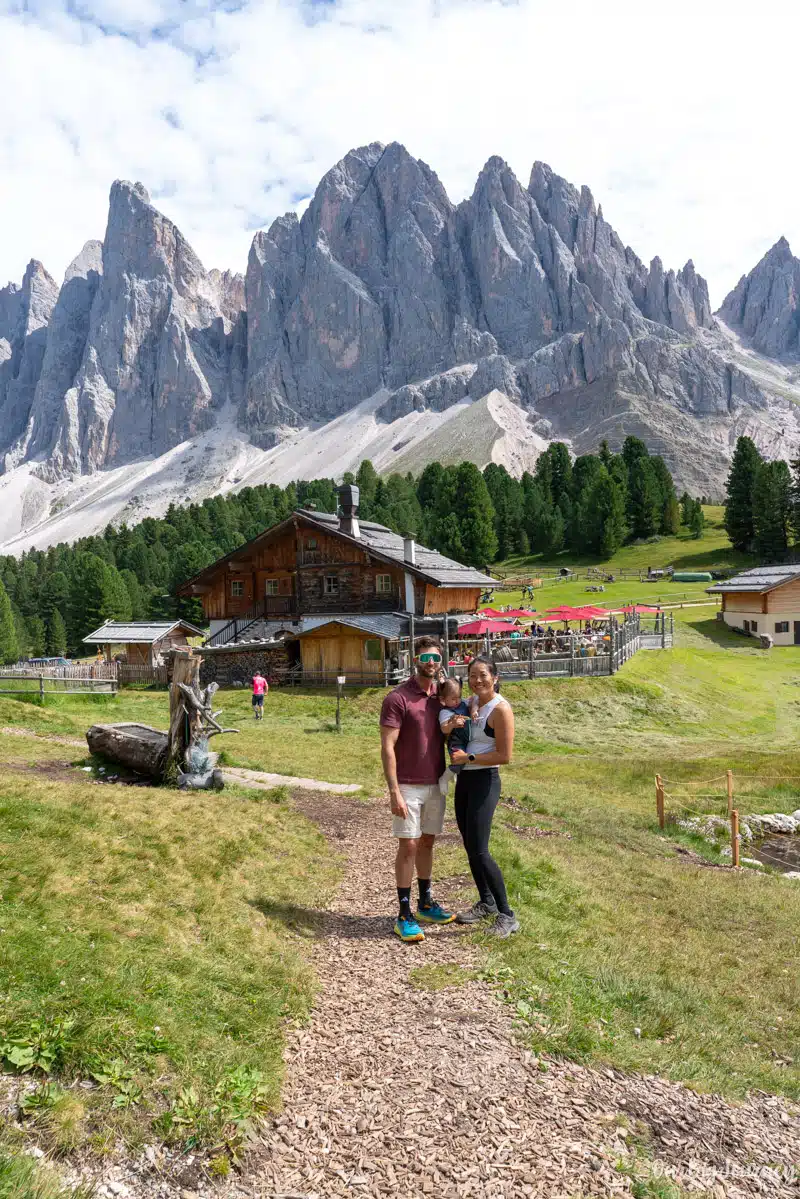
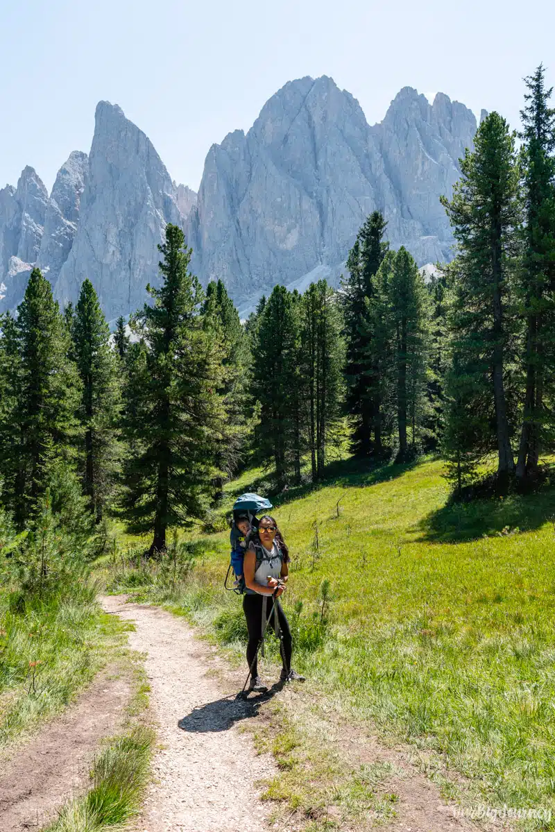
Table of Contents
Basic Hiking Info
Key Highlights about Adolf Munkel Trail
- Distance: The hike is a 10 km loop. Some people do in-and-out hikes, and there are longer alternatives. For us, this was a perfect balance between a day-hike while still getting epic views.
- Difficulty: Medium. The hike is easy to walk, there are several huts to take breaks and it’s easy to follow. However, 10 km is a decent distance and the elevation loss/gain is around 400 m.
- Duration: You can estimate 3-3.5 hours plus breaks and photos.
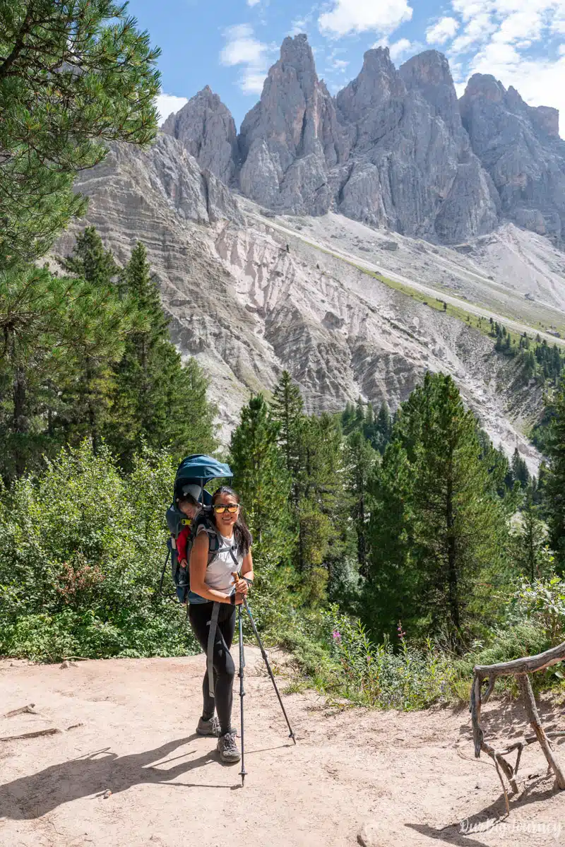
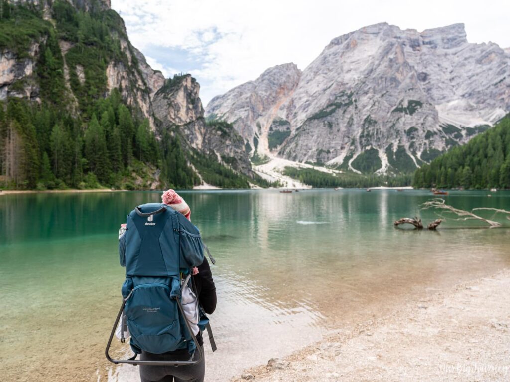
- Accessibility: This one can’t be done with stroller or wheel chair. For babies, we recommend a good carrier. Kids over 6 can do it with time… and patience.
- What to bring: hiking or good trail running shoes. Weather in the Dolomites is tricky.
- Best time to go: Late June to early October for snow-free trails. After all the Dolomites posts I’ve done, I think this is the usual.
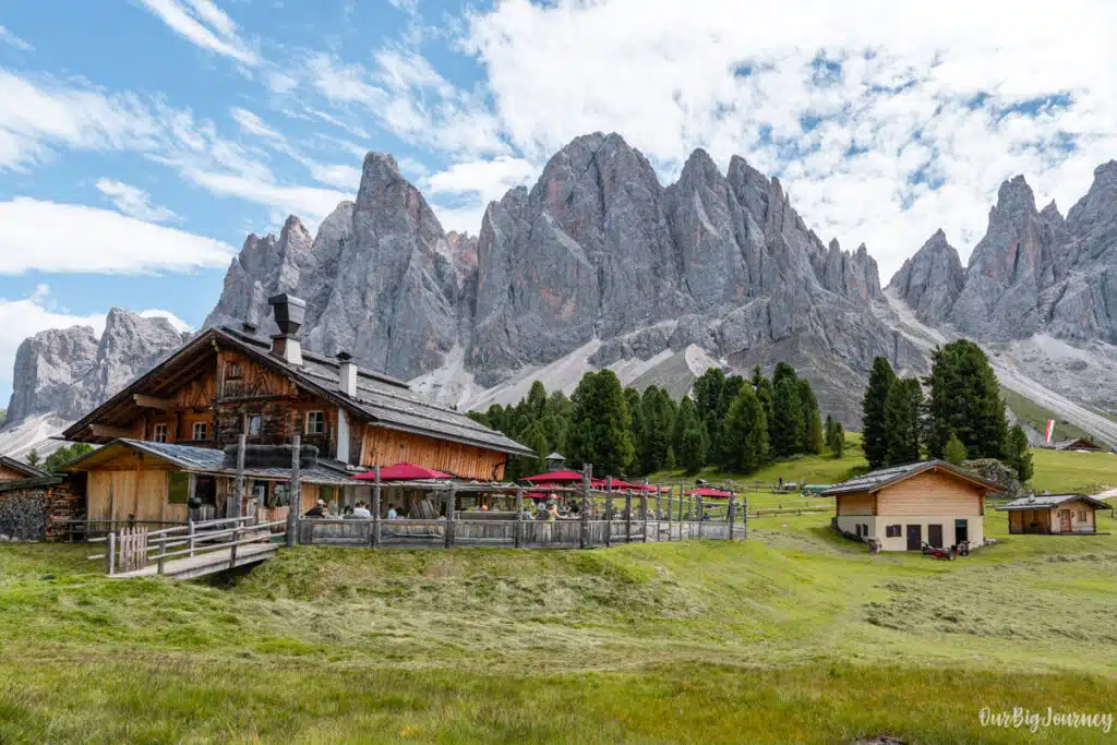
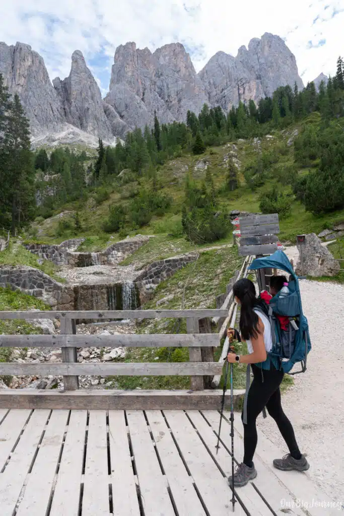
- Photographers: There are multiple good spots for photography but GeislerAlm (also known as Rifugio delle Odle) offers breathtaking views. The best stop of the hike.
What makes Adolf Munkel Trail special
The Adolf Munkel Trail is a bit like Seceda, it offers a unique combination of really good landscape, medium difficulty hiking and a chill vibe with the shelters. The best things about Adolf Munkel hike (in our opinion) are:

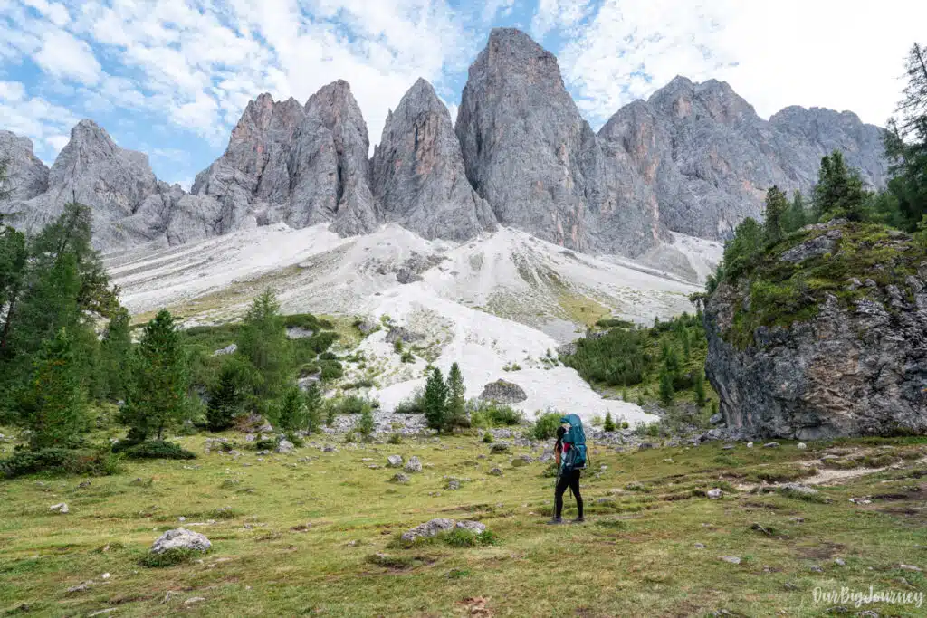
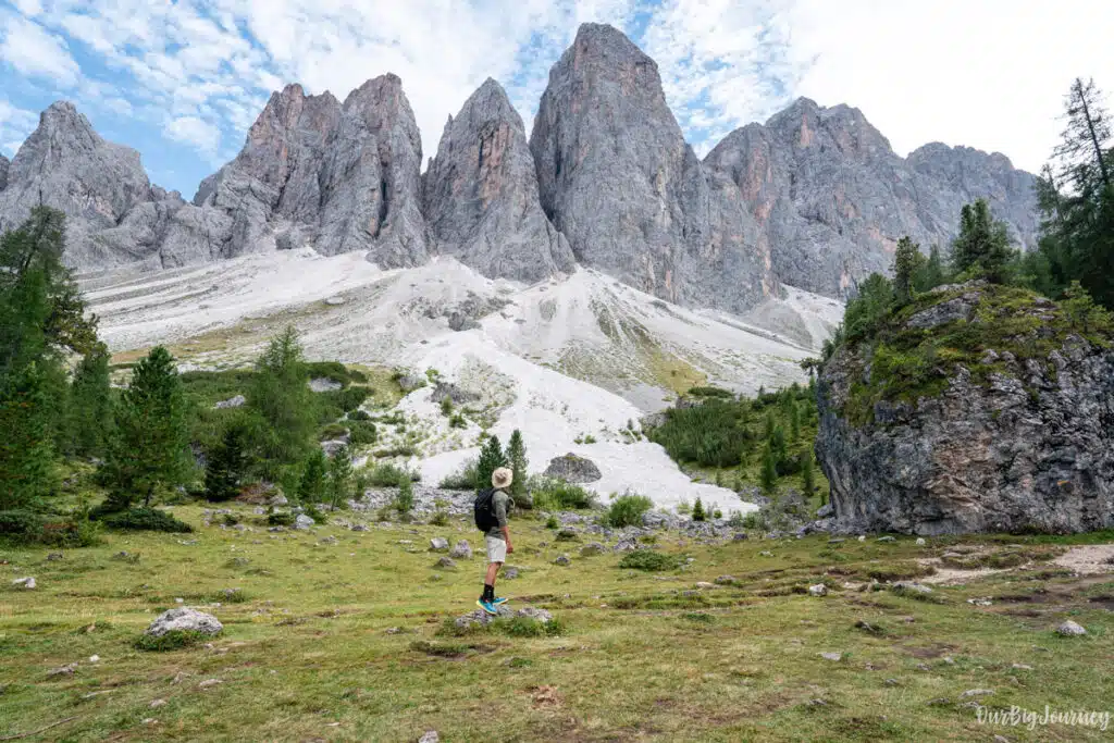
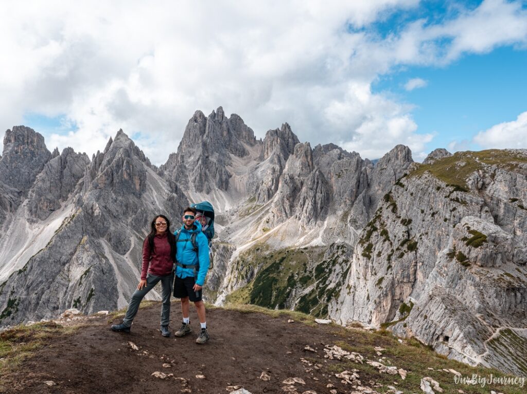
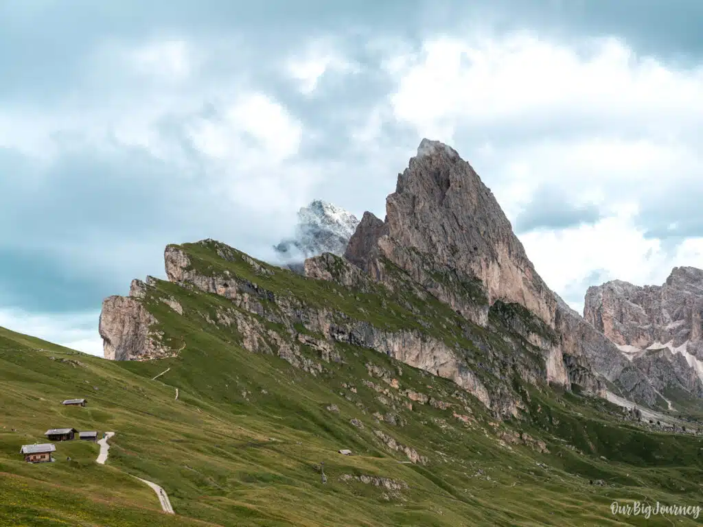
- The views of the Odle (Geisler) peaks. You hike towards them and very close to these peaks. Some parts are super photogenic.
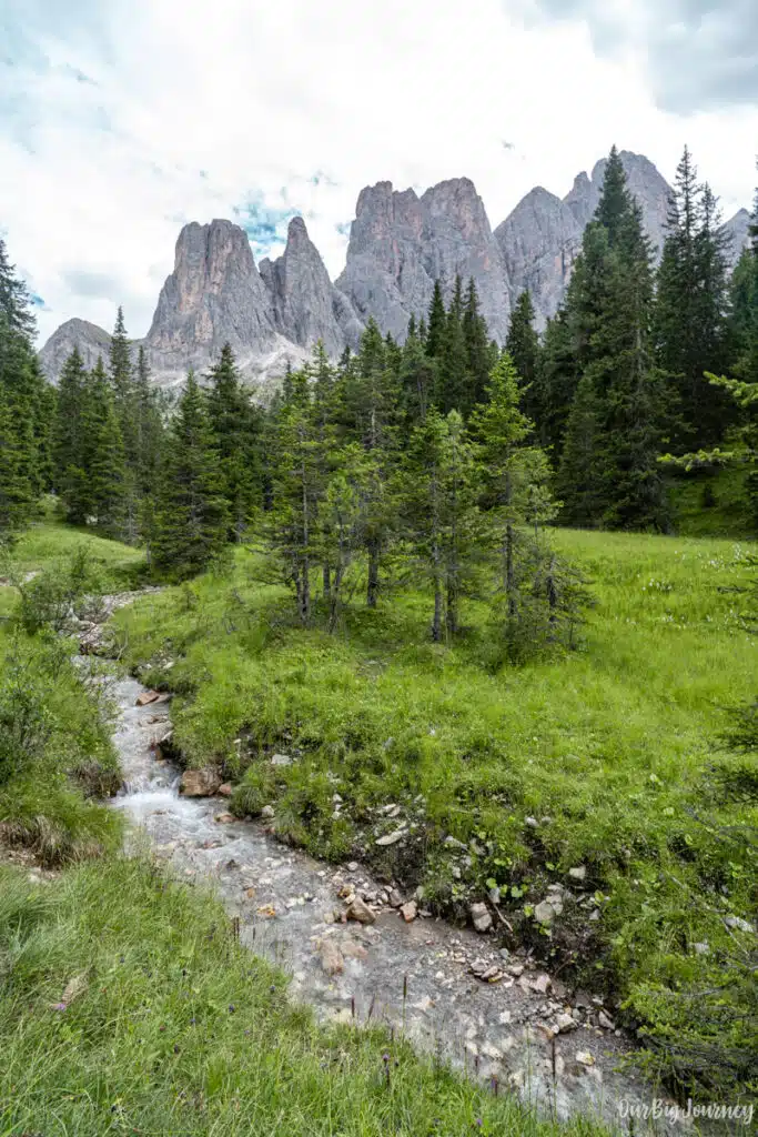
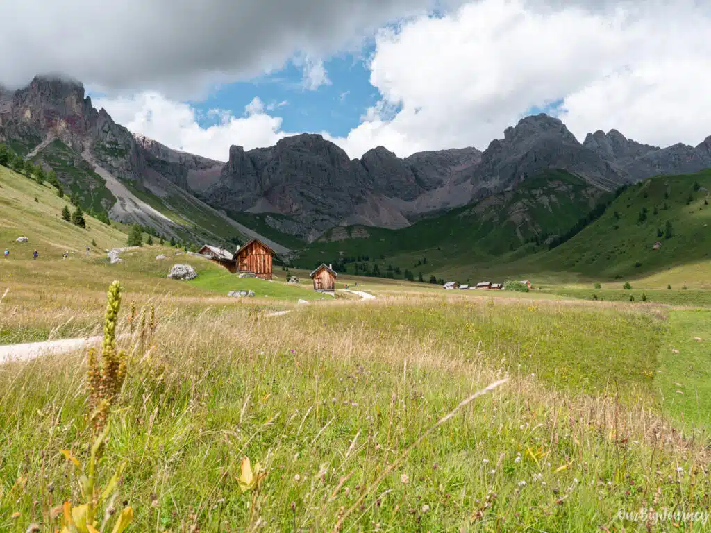
- Changing views. From meadows, alpine huts, forest sections, and open viewpoints all with the peaks looming above.
- It’s accessible. Quite easy to get there and park, manageable for many intermediate hikers, and can even be enjoyed with children.
- Not overpacked. The valley itself, Val di Funes, is quieter than some of the busier Dolomite hubs. You get stunning mountain scenery without the sense of being in a massive tourist machine.
- The rifugios and the food. This is common in the Dolomites, but for us, coming from the States and Spain, it is so nice to have these places with quality food in the middle of the mountains.
To wrap it all up, if you want a “Dolomites experience” but without going on a very hard mountaineering route, this is a top choice.
How to get and hike the Adolf Munkel Trail
Where to start the Adulf Munkel hike
Getting to the starting point of Adolf Munkel Trail is quite simple.
Val di Funes is in South Tyrol, in the Dolomites. The trailhead is at the parking lot of Zanser Alm / Malga Zannes. To get there just check the parking in Google.
How to get there
- By car: This is what we did. Drive through the valley via the main road (coming for example from Brixen/Bressanone) to Santa Maddalena (St Maddalena) then onwards to the parking at Zans.
- By bus: There is a bus line (#330) from Bressanone/Brixen to Zanser Alm. It’s possible to do many hikes in the Dolomites without a private car, actually.
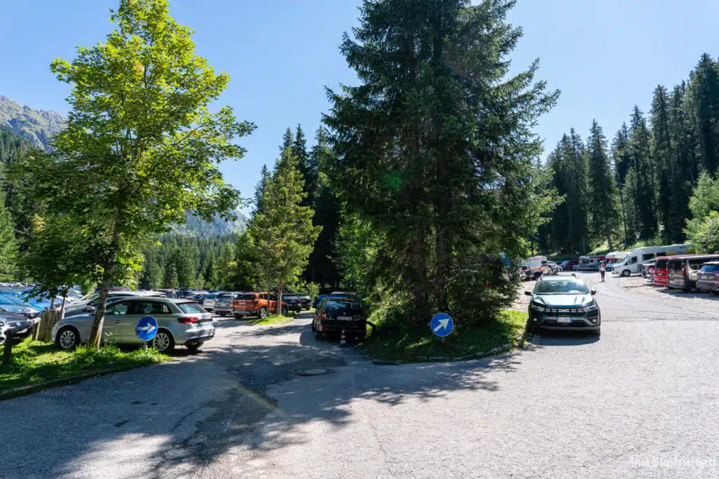
- Parking: At the trailhead paid parking is required (the lot fills up early in high season). When we went in the beginning of August, the parking started to get packed and some cars couldn’t make it. So they had to wait until others left.
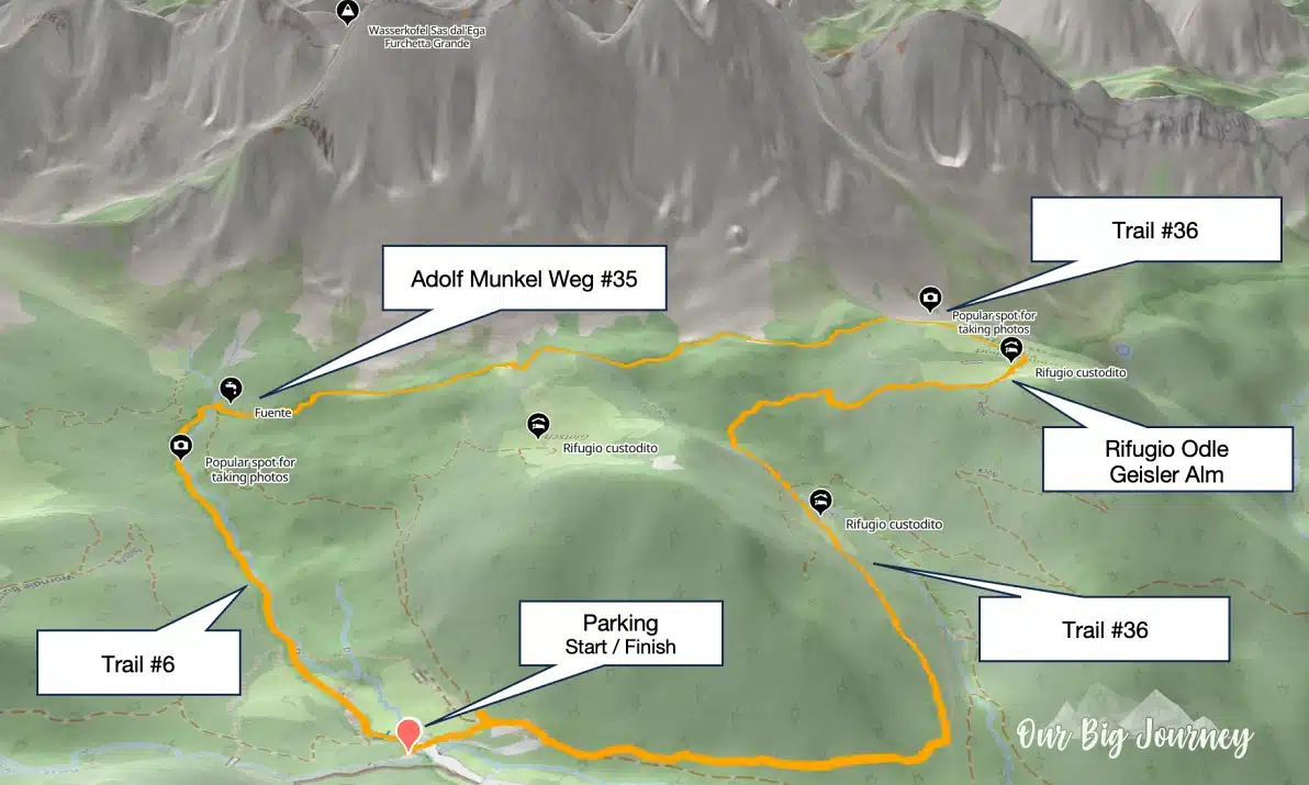
The route to follow
The hike is easy to follow because there are big trails to follow: Trail #6, then #35 or Adolf Munkel Wet, and then Trail #36. BUT in our opinion there are many signposts with trails, secondary trails, optional trails, shortcut trails… We are not bad at following indications but for some reason we found it a bit confusing, or maybe that day we were just a bit sleepy, who knows.
Anyways, I’ve prepared this map with the route to follow, or at least, the most common one. But there is one last thing that I found interesting…
Adolf Munkel Clockwise or Counter-clockwise?
From other travel blogs that have done this hike, I found something interesting. People who did it counter-clockwise, enjoyed it more than who people who did it clockwise.
My theory is that, by going clockwise, you start going up gradually and constantly following a path that is just “meh” between trees. Later you see the Odle mountains when you get the Trail #35 more or less and then you get to the rifugios after you have hiked going up around 55% of the total distance of the hike. To go down, you through the forest trail #36.

But when you go counter-clockwise, the hike starts going up with more intensity through the forest for 45% of the total distance. It gets even tiring at some points because it’s more inclined than the other version. And when you’re tired, you reach the top, and BAM! you have amazing views of the Odle peaks. Then, just a bit further you get to Rifugio Odle / Geiler Alm, with an amazing location. Now you have a longer path to go down and still see the mountain range on your right.
I think doing Adolf Munkel Trail counter-clockwise, immerses you more in the hike through the woods in an intense way up, surprises you with the incredible views at the top, and lets you go down in a more chill and less interesting path, where you can speed up a bit.
Our experience hiking Adolf Munkel Trail
Start at Malga Zannes parking
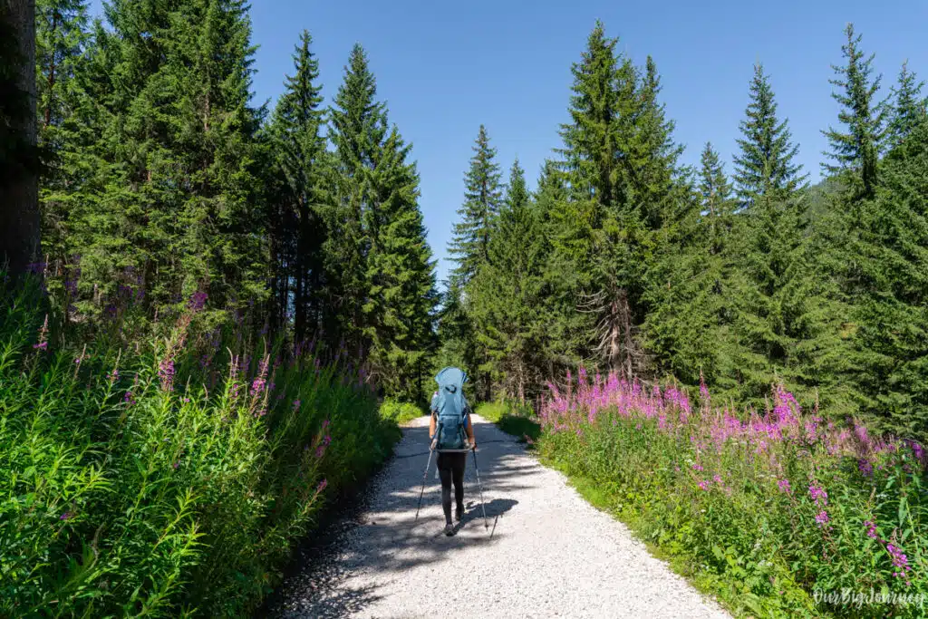
We started our adventure by driving through Val di Funes heading towards the parking lot of Zanser Alm / Malga Zannes. The road was quite empty around 10 am but when were reaching Malga Zannes parking, we were in a line of cars because the parking lots were already getting full. After paying 10€ for our car (16 € for campers), – credit card accepted – we entered the parking and found, with some difficulty, one spot. This is why we don’t recommend coming later than 10 am.
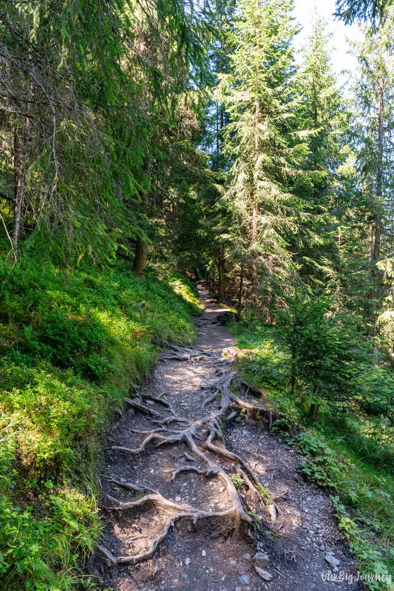
Once we packed everything for the day, including Lara’s things (this always requires extra time), we started our hike following Trail #36. At first the path is quite flat, and soon goes through the woods with a lot of shade coverage. The environment is different from the typical views of the Dolomites, and gave us more Pyrenees / mid-mountain vibes, with more forest.
All the way up
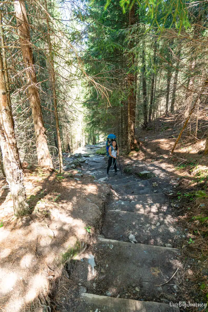
At some point, the path starts to get quite steep and goes up and up for a few kilometres. Sometimes with shade in the forest, and sometimes under the sun, but always with a nice fresh feeling. We were surprised by the hill because it is non-stop 400 meters going up. We started to take some breaks and Ellen said her classic line of the trip: “ I wouldn’t say this is an easy hike, it feels more like medium.”
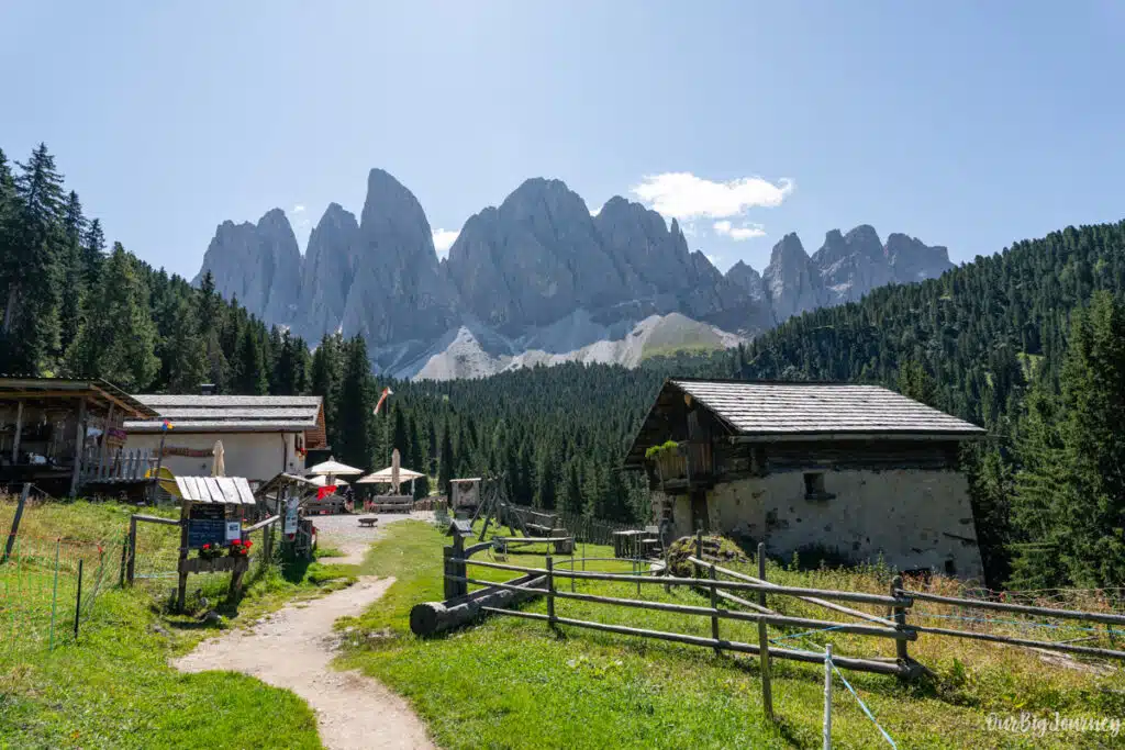
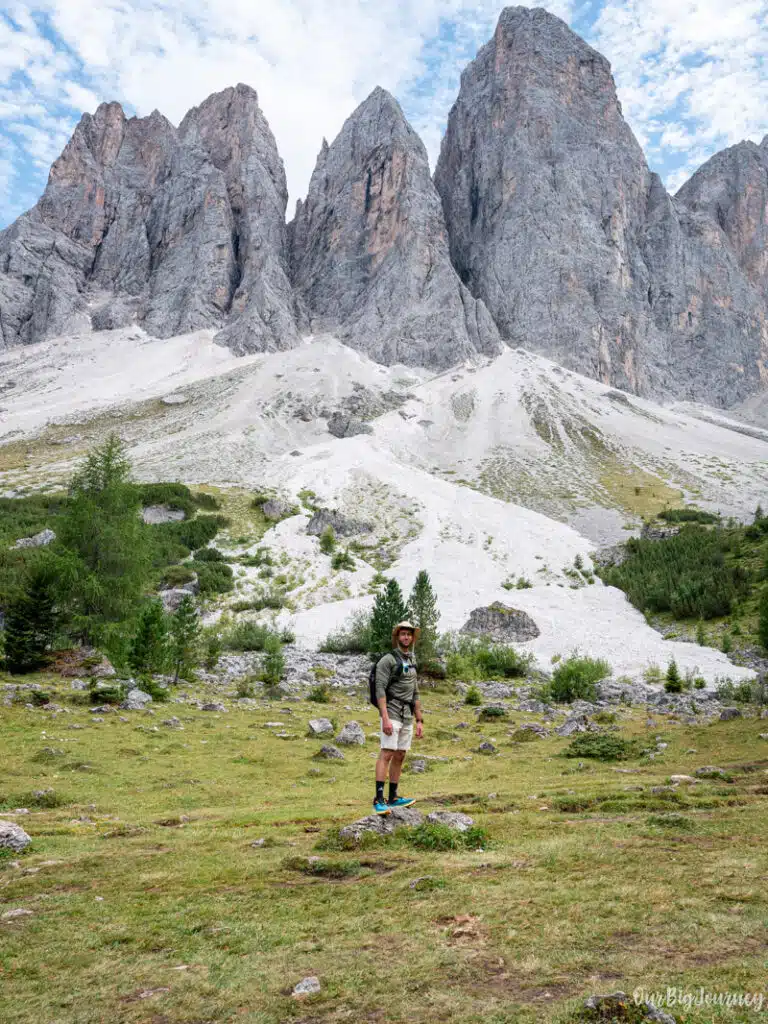
We kept going up and getting hungry, while the sun was up. And it was there, at the end of our sight: the views of the peaks from Odle Group, and our next big break: the Rifugio delle Odler.

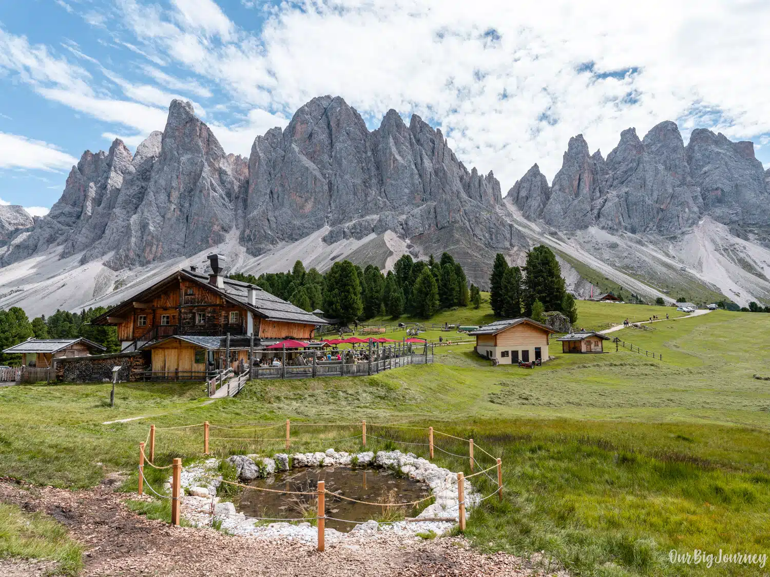
Rifugio delle Odler or Geisler Alm
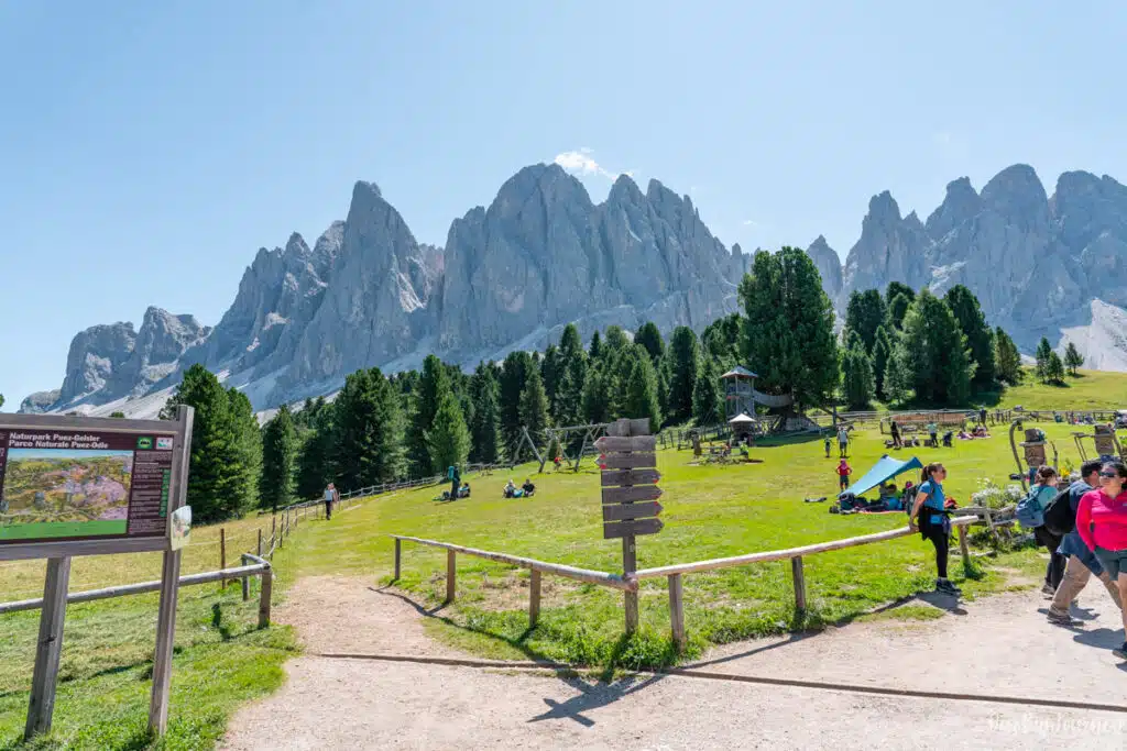
For us, this was the highlight of the hike. Rifugio delle Odler or Gisleralm is located at 1996 m above sea level and perfectly located at the heart of the Puez-Odle Nature Reserve. The views from there are extremely photogenic. But not only that, the Rifugio has a meadow with many lounge chairs and wood sofas, to rest and enjoy the breeze and sun with exceptional views.
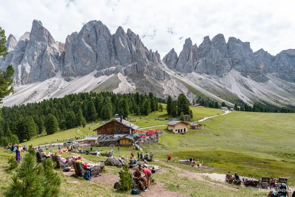
Also, for the babies they have the biggest playground we saw in the Dolomites. They also organise tours, offer shuttle bus and many other services. Definitely one of the best rifugios in the area.

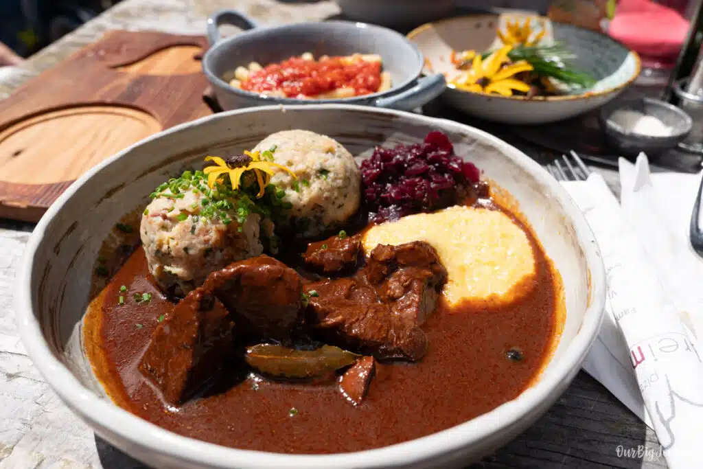
We had lunch there and the food was really good, plus they had a good variety compared to other rifugios. After we were done with our coffees, we put Lara back on my back and headed out for the second part of the hike. This time, with full bellies and many good photos from this awesome place.
Going down where the Odle mountains grow
Right after leaving behing Rifugio delle Odle, you spot another rifugio: Malga Casnago. We didn’t stop in this one so we can’t provide any opinion. Instead, we kept going to the mountain peaks, until we started to finally go down. This part of the path goes less among trees and is more open, with views of the tall peaks of dolomite, in certain areas.
We saw many more people coming this way towards us, than in the first part of the hike. And we started our hike with almost nobody. This means that a majority of people do this hike clockwise. We stopped here and there and took photos in some nice spots.
Going back to the parking
Step by step we were going down and followed the proper Adolf Munkel Weg Trail. This trail was designed to guide hikers through the heart of the Dolomites. Originated in 1905 by the Dresden Alpine Association, they decided to name it Adolf Munkel, to honor the association’s first chairman and a notable German mountaineer. This path leads you to Trail #6, that goes in the woods again with a big path (not like trail #36) and finally ends in the parking where you started hours before.
Final thoughts: is Adolf Munkel worth it and a good hike with kids?
It’s true that this hike is not as impressive as Seceda, has less crazy views like Cadini Di Misurina, and doesn’t have the open space as Tre Cime. It also it has a “classic hike” vibe and feels less like a Dolomite’s hike. But there is something about Adolf Munkel Trail that we really liked. Maybe it is that we got a perfect sunny day, we liked hiking through the woods, and the rifugio with epic views captivated us. In the end, you can remember a place by its beauty or difficulty, but also by the feelings and the experience you had.
That’s why for us Adolf Munkel Trail is a hike to recommend for an excursion-day in the Dolomites. About doing it with kids, absolutely yes. If you go with a baby like we did, the path is not risky at all. With kids it’s also a hike I would recommend, because despite being 10 km, there are multiple stops and rifugios. We encourage you to add Adolf Munkel Trail to your top things to do in the Dolomites. Enjoy!
More posts of pure Dolomite!
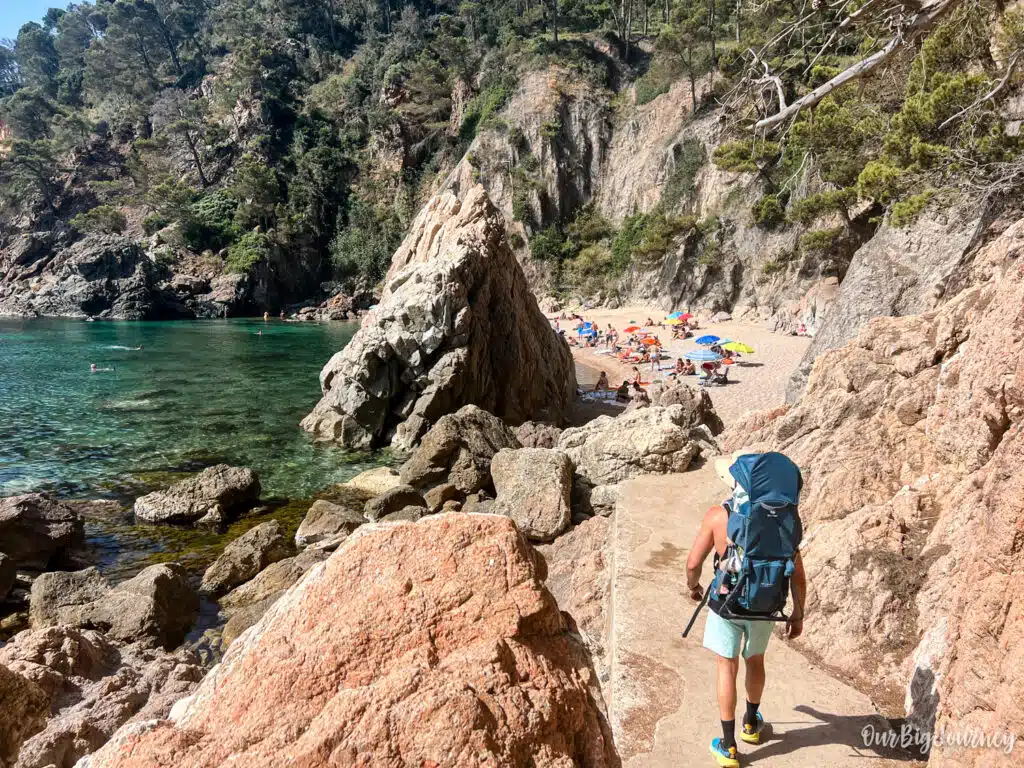
El Golfet Beach | Easy Family Walk in Costa Brava
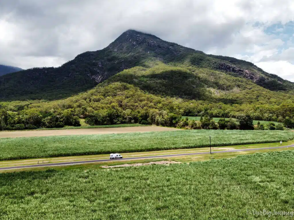
Australia East Coast Road Trip: Sydney to Cairns in 5 weeks
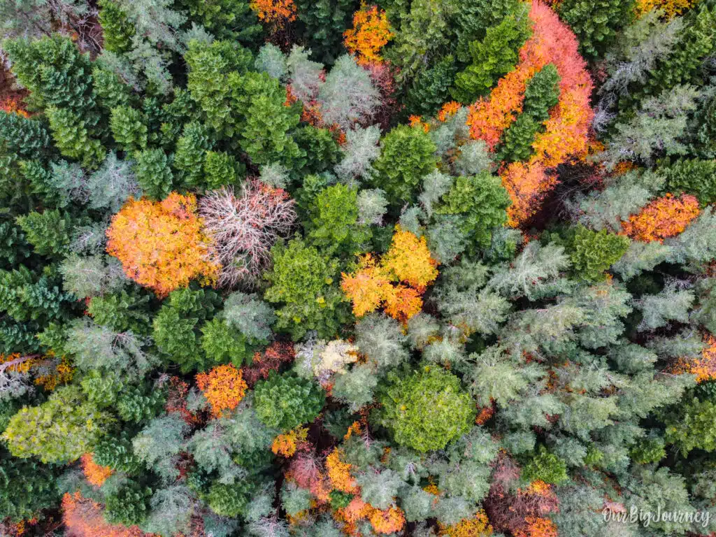
Selva de Oza | Autumn in the Pyrenees
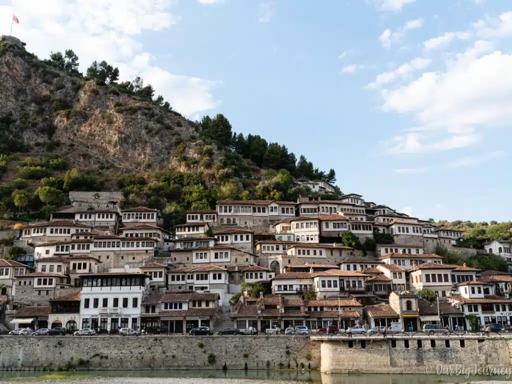
Berat in Albania | Guide and Things To Do
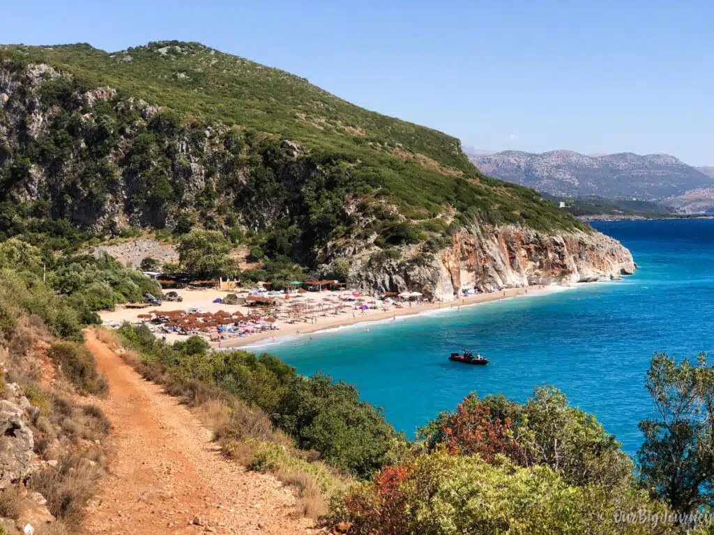
How to get to Gjipe Beach | Albania Riviera